Started By
Message
2019 Tennessee River Valley Flooding Thread
Posted on 2/23/19 at 10:25 pm
Posted on 2/23/19 at 10:25 pm
So I live on the Tennessee River (Pickwick Lake, Counce, TN) and things are getting crazy around here. Severe flooding all across north Alabama, parts of MS, and middle/western TN, and some people are having a really tough time. Idk how many ppl around here are being affected by it but I thought we could try to pool all the relevant information in here. I’m gonna start editing the OP posting river gauges along with pictures.
Keep in mind that whatever we are dealing with in these areas is headed to the Mississippi River for the most part then headed south so this is going to be a major issue for the long haul as far as flooding goes. Supposedly the Tennessee is going to reach its highest levels since being dammed up by the TVA in the 30s
Prayers for all of those in need
Each Red box in this image is a segment of river at flood stage

I'm going to leave most of the Mississippi River stuff to the OT as im sure a mega thread will emerge there eventually but here is just a forecast map as of February 22nd


this is just a flooded main highway where i live
Keep in mind that whatever we are dealing with in these areas is headed to the Mississippi River for the most part then headed south so this is going to be a major issue for the long haul as far as flooding goes. Supposedly the Tennessee is going to reach its highest levels since being dammed up by the TVA in the 30s
Prayers for all of those in need
Each Red box in this image is a segment of river at flood stage
I'm going to leave most of the Mississippi River stuff to the OT as im sure a mega thread will emerge there eventually but here is just a forecast map as of February 22nd
this is just a flooded main highway where i live
This post was edited on 2/24/19 at 9:52 pm
 4
4


Posted on 2/24/19 at 8:45 am to Wishnitwas1998
It's really bad in Knoxville. Somebody drowned last night trying to drive through a flooded intersection and entire interstate exits and major roadways are completely under water.
This is 5 minutes from my house in North Knoxville.

The Campbell Station Rd. exit out in West Knoxville:

This is 5 minutes from my house in North Knoxville.
The Campbell Station Rd. exit out in West Knoxville:
This post was edited on 2/24/19 at 8:48 am

Posted on 2/24/19 at 9:59 am to Wishnitwas1998
quote:
So I live on the Tennessee River (Pickwick Lake, Counce, TN)
My cousin said last night that every road going to the mill was closed. We're going to Savannah to get a truck today, hopefully we won't run into much rouble.
Posted on 2/24/19 at 11:44 am to Bama Shadow
I’m about to head to Savannah right now myself, if you aren’t going over the Pickwick dam be very sure your route won’t be flooded out somewhere. I think every road in Shiloh park has a flooded section somewhere or just about it
And yea highway 57 (road the papermill is on) is flooded in multiple places either side of the mill
I’m gonna try to get some pics in here this afternoon, this is gonna be every bit as bad as 73-74 and it’s heartbreaking
And yea highway 57 (road the papermill is on) is flooded in multiple places either side of the mill
I’m gonna try to get some pics in here this afternoon, this is gonna be every bit as bad as 73-74 and it’s heartbreaking

Posted on 2/24/19 at 2:43 pm to Wishnitwas1998
Drove from Columbia to Knoxville on Friday for a Birthday party. Got word yesterday that I40 in NC was closed due to a rock slide.
On my way home now, was rerouted through Newport,TN
On my way home now, was rerouted through Newport,TN
Posted on 2/24/19 at 4:08 pm to Vols&Shaft83
quote:redneck capitol of Tennessee.
Newport,TN
Posted on 2/24/19 at 4:21 pm to TT9
quote:
redneck capitol of Tennessee
Wouldn't frick with anyone from Cocke county, they are all irl armed psychopaths
Posted on 2/24/19 at 10:06 pm to Vols&Shaft83

Here is the gauge at Savannah, TN, thankfully it is supposed to be cresting Monday night

gauge at Pickwick Lake on the Tennessee River
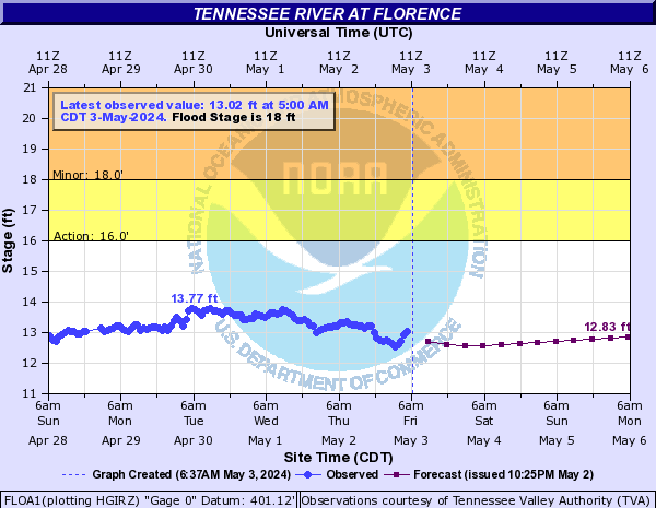
Florence, AL
Decatur, AL

Posted on 2/24/19 at 10:13 pm to Wishnitwas1998
Flooding in Florence, AL


A fricking house floating down river today near Savannah, TN, suspected to be user Oleyeller's former dwelling
A fricking house floating down river today near Savannah, TN, suspected to be user Oleyeller's former dwelling
This post was edited on 2/24/19 at 10:14 pm
Posted on 2/24/19 at 10:34 pm to Wishnitwas1998
quote:
I’m gonna try to get some pics in here this afternoon, this is gonna be every bit as bad as 73-74 and it’s heartbreaking
My mother is from Savannah. She and my father are now retired there, and she told me yesterday that the flooding will be worse than 1973.
Posted on 2/24/19 at 10:38 pm to Bankshot
I’ve heard talk that it’s supposed to be but nothing official that says it, the forecasted crest has lowered a little from what they were saying a few days ago so idk if it’s gonna get there or not but either way it’s been a very bad time for a lot of ppl
Part of the county and part of McNairy counties are now without drinking water due to the flooding knocking a pumping station offline
Part of the county and part of McNairy counties are now without drinking water due to the flooding knocking a pumping station offline

Posted on 2/24/19 at 10:41 pm to Wishnitwas1998
Geez that's terrible.
Posted on 2/24/19 at 10:53 pm to Bankshot
looking at the gauge the crest is currently forecasted to be at 394 and the record is 401 though im having a hard time determining when that record was set and its possible it was before the River was impounded by the TVA so it could be an apples to oranges comparison as far as flood severity
ETA: ok so im dumb and the numbers were right in front of me the entire time, the record of 401 was set in 1897 so before the River was impounded. 1973 produced the second highest measurement of 396.11 ft so as of now it should fall just short of that
As an aside, while the River was at a lower level in 1973 versus 1897 it discharged and carried a higher volume of water 1973 than 1897 so it's not quite straight forward as to which flood was "worse". There are other dynamics involving channel depth and so forth that explain how this is possible but im not smart enough to sit here and try to explain it
This post was edited on 2/24/19 at 10:59 pm
Posted on 2/24/19 at 10:53 pm to KSGamecock
yea and honestly i wish there was enough time to post enough pictures to do it justice, what is in this thread hardly scratches the surface

Posted on 2/25/19 at 12:43 am to Wishnitwas1998
Murfreesboro has been relatively flood free thank god. Lot of standing water but nothing over a few inches on the roads, only a couple are closed afaik.
West knox is apparently a damn shite show
West knox is apparently a damn shite show
Posted on 2/25/19 at 6:26 am to Wishnitwas1998
It's a really sad situation around here. From what I gather the earthen part of Pickwick dam is at it's limit and is why TVA is sending so much to KY lake. A friend in Savannah has shown me several pics of houses and businesses under water. Not to mention the tales of livestock being stranded with no way to get them out.
Posted on 2/25/19 at 10:47 am to Bama Shadow
I really doubt it’s at any sort of limit and I haven’t heard anything to that extent but it’s possible I suppose
If it was at its limit they likely wouldn’t have opened Wilson and Wheeler wide open so quickly, I think it’s just that there’s so much water and more coming and it’s got to go somewhere
One bit of good news around Savannah is that it’s still rising but they have again lowered the forecasted crest, I’ll try to get the gauge posted in here this evening
Posted on 2/25/19 at 11:15 am to Wishnitwas1998
quote:
One bit of good news around Savannah is that it’s still rising but they have again lowered the forecasted crest
I hope that's the case. My cousin's wife posted some pics on Facebook of their property. The fields below their house are flooded completely. The cattle on the property had to be moved to higher ground more than a week ago.
Posted on 2/25/19 at 12:37 pm to Bankshot
At least they had a place to move them to, several ppl didn’t 
This post was edited on 2/25/19 at 1:13 pm
Posted on 2/25/19 at 2:44 pm to Wishnitwas1998
Supposedly the river has created at Savannah and they may start holding back at little more water at Pickwick. I pray that’s true

 Page 1 of 1


Popular
Back to top